

onX Hunt Features
Made by hunters, for hunters: everything you need to increase your confidence and odds of success, from scouting through to hunting season.
Made by hunters, for hunters: everything you need to increase your confidence and odds of success, from scouting through to hunting season.
Land Ownership Data:
Know Where You Can Legally Hunt
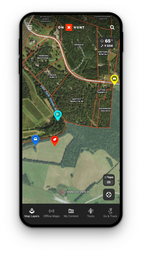
The Most Accurate Land Ownership Data
Navigate property lines with confidence with GPS tracking and updated, clearly-marked boundaries. Our proprietary data collection, analysis, and layering methods handled by our Geographic Information System (GIS) team give you the most accurate and up-to-date maps available on all devices—in one place.
Dive Into Detailed Land Information
onX is home to information on more than 121 million properties across the country. Easily view property lines and names on the map, then simply tap to view landowner name, tax address, and acreage. Plan your next hunt with maps covering more than 852 million acres of public land, 9,568 unique hunting units, 421 map overlays, 400,000+ miles of trails, and 50,000+ campgrounds and cabins.
NEW – Tree Species & Habitat Layers
Duration – 12:32
Learn how to use the new Tree Species & Habitat Maps in onX Hunt with Matt Seidel. With hundreds of Map Layers, you can quickly identify what trees are in your area so you can target where the game you are pursuing is at. Choose between Deciduous, Coniferous, Aspen, Oak, and more. Use the new Tree Species and Habitat Maps for your next hunt.
Map Tools: Customize and Share Waypoints, Tracks, and Areas
![]()
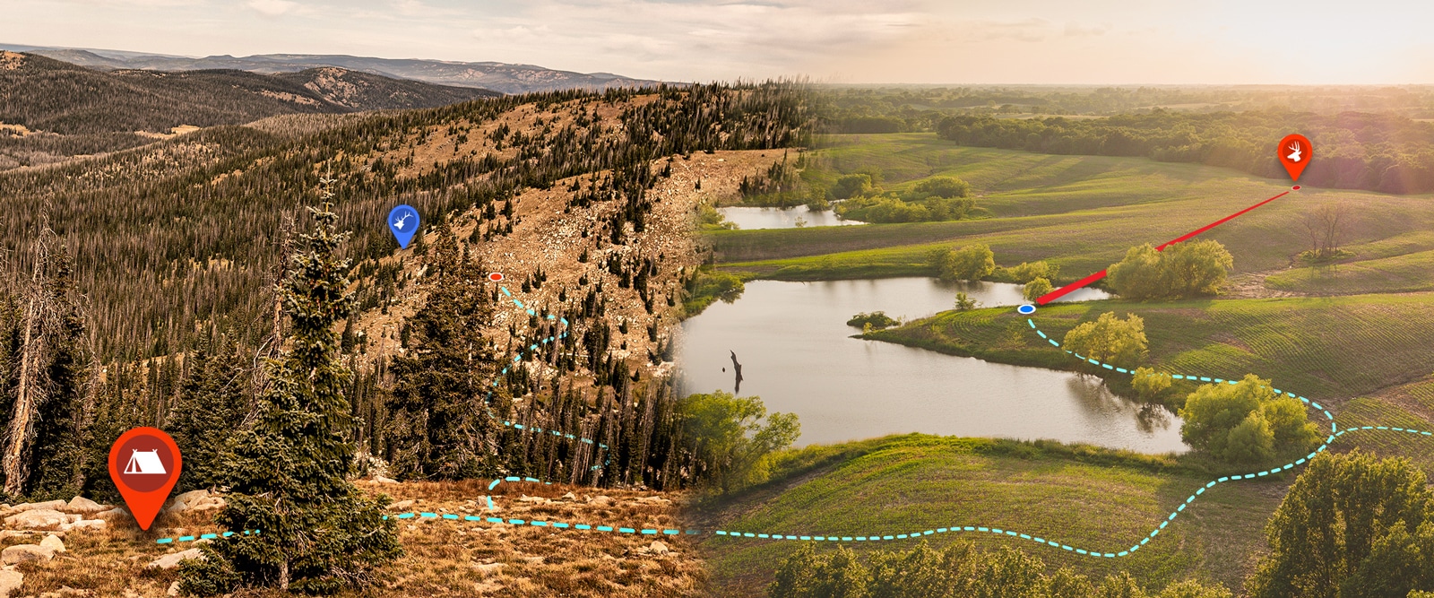
Build Your Map to Find Elk
Mark and customize Waypoints for wallows, rubs, trails, and other elk sign to help you understand possible elk movement. Use the Tracker to map these routes, then share these Tracks for friends or family so they can easily follow your footsteps. Use the Line Distance Tool to plan hunting routes and gauge both distance and elevation for your hike.

See Your Property In a New Way
Mark each tree stand, trail camera, and deer sign on your property with custom Waypoints to help you visualize new stand sites, analyze how deer use your land, and ultimately make you more successful by gaining a deeper understanding of the property you hunt. Use the Area Shape Tool to size up your food plot, and the Tracker Tool to map out the best entrance and exit routes to your tree stands.
Basemaps for Hunters: Topographic, 3D, and Beyond
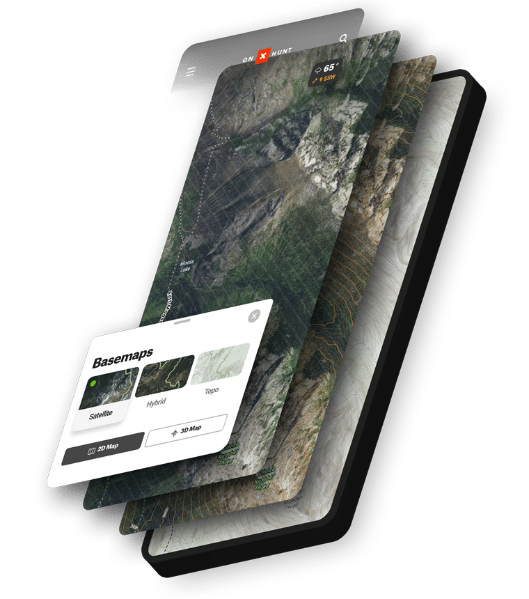
Satellite, Hybrid, and Topo Basemaps
onX Hunt provides three types of Basemaps, helping hunters understand the landscape and how to move through it. Satellite shows aerial imagery of terrain. Topographic gives a two-dimensional representation of Earth’s three-dimensional landscape. Hybrid is the perfect blend of Satellite and Topo, combining all of the advantages of topographic maps and aerial imagery to provide hunters with the most comprehensive look at the land.
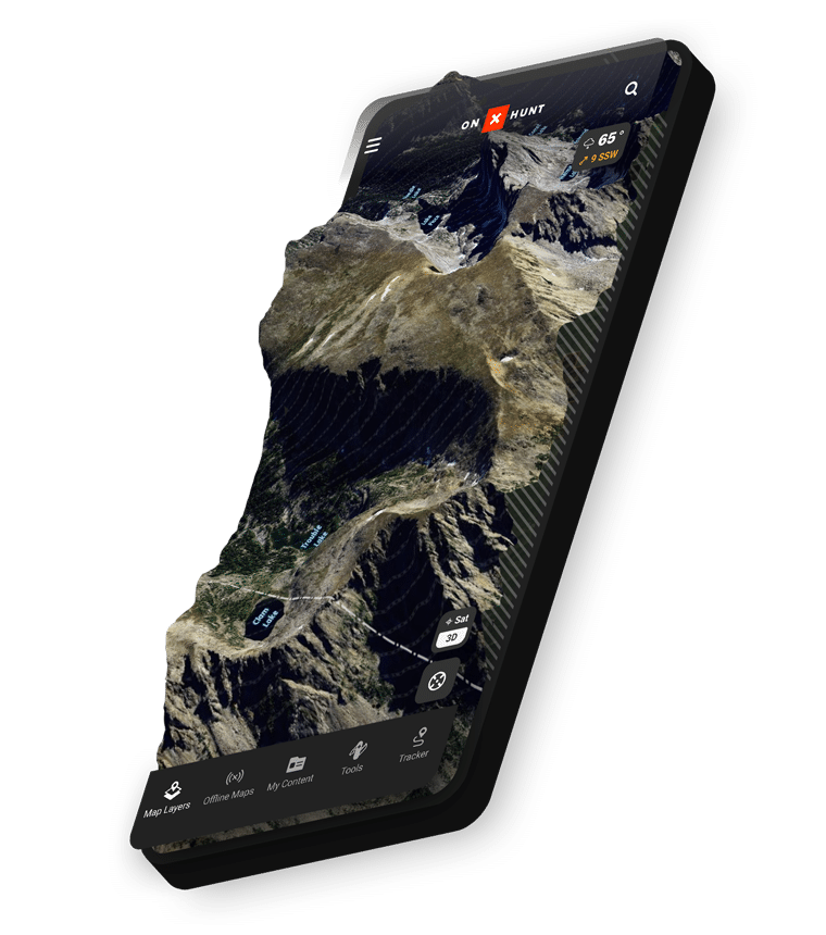
E-Scout With 3D Maps
Understanding the lay of the land is a critical factor in determining the success of your hunt, and our 3D Maps on desktop and mobile allow you to do exactly that. Combined with features like our Hybrid Basemap, the ability to view 3D Maps gives you the tools you need to understand how animals move across the landscape—and where you need to be to cross their paths.
Hunting Layers
Overlay Wildfire Data, Hunting Units, Timber Cuts, Crop Data, and More
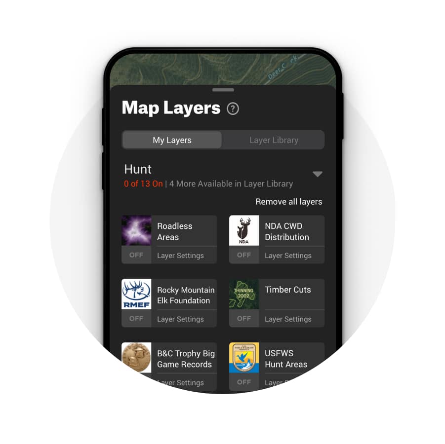

How onX Map Layers Work
Map Layers allow you to customize your map for your hunt. Based on the species and region you hunt, you’ll want to turn on layers that are relevant for your location and species. onX Layers allow you to customize your map to give a personalized experience.
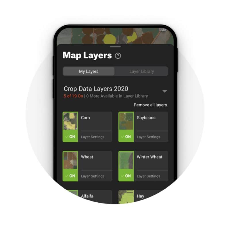

Map Layers for Every Hunter
Our state-specific Map Layers include property boundaries, landowner names, and state-specific hunting information. Within the Hunt Layer Category, you’ll find layers such as Historic Wildfires, Roadless Areas, and others. Look in the Trails & Rec Layer Category for recreation sites and other points of interest as well as trails, trail mileages, and trail slopes.
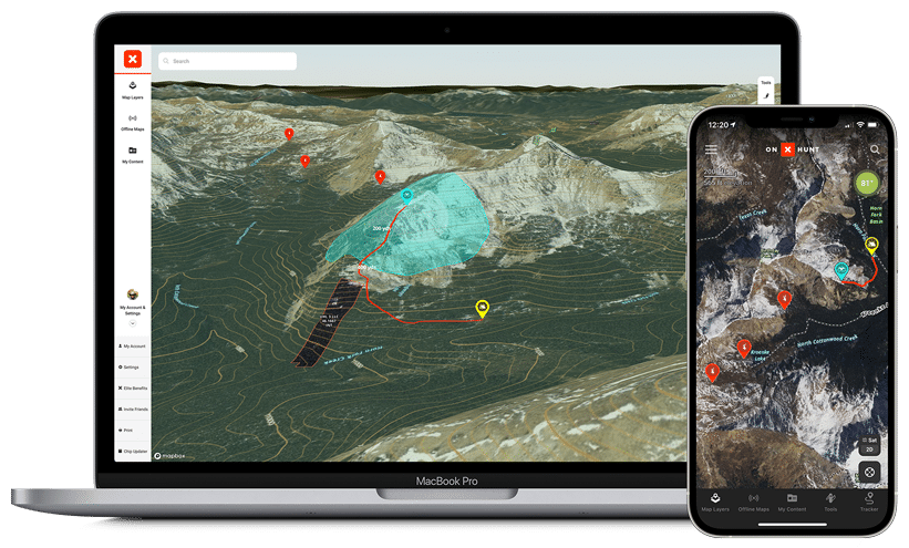
Desktop Maps for Better Planning
Sync Your Maps Across All Devices
onX Hunt members get complete access to onX Hunt on their desktop computers—perfect for serious e-scouting on a bigger screen. Using desktop maps with 3D Mode allows you to research, evaluate, and plan for a hunting area before you get boots on the ground. Your Map Markups (Waypoints, Lines, Shapes, and Tracks) and all the data you save on your desktop syncs across all of your devices so you can take advantage of scouting time to be more efficient, knowledgeable, and successful when you hit the field.
Wind & Weather in the onX Hunt App
Weather Updates From 100,000 Weather Stations, Updated Every 15 Minutes
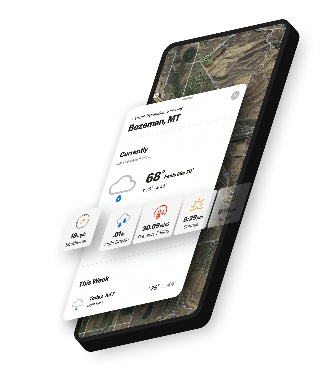

Current and Forecasted Weather
Once you have your hunting spot picked out, the next step for any hunter is knowing the weather forecast and how it’s going to impact your hunt. Live weather reports, weather forecasts, wind direction, sunrise / sunset times, and barometric pressure are all curated within the onX Hunt App to keep everything you need in one convenient place. Large, intuitive visuals make it easy for hunters to identify upcoming weather patterns and make in-the-moment decisions.
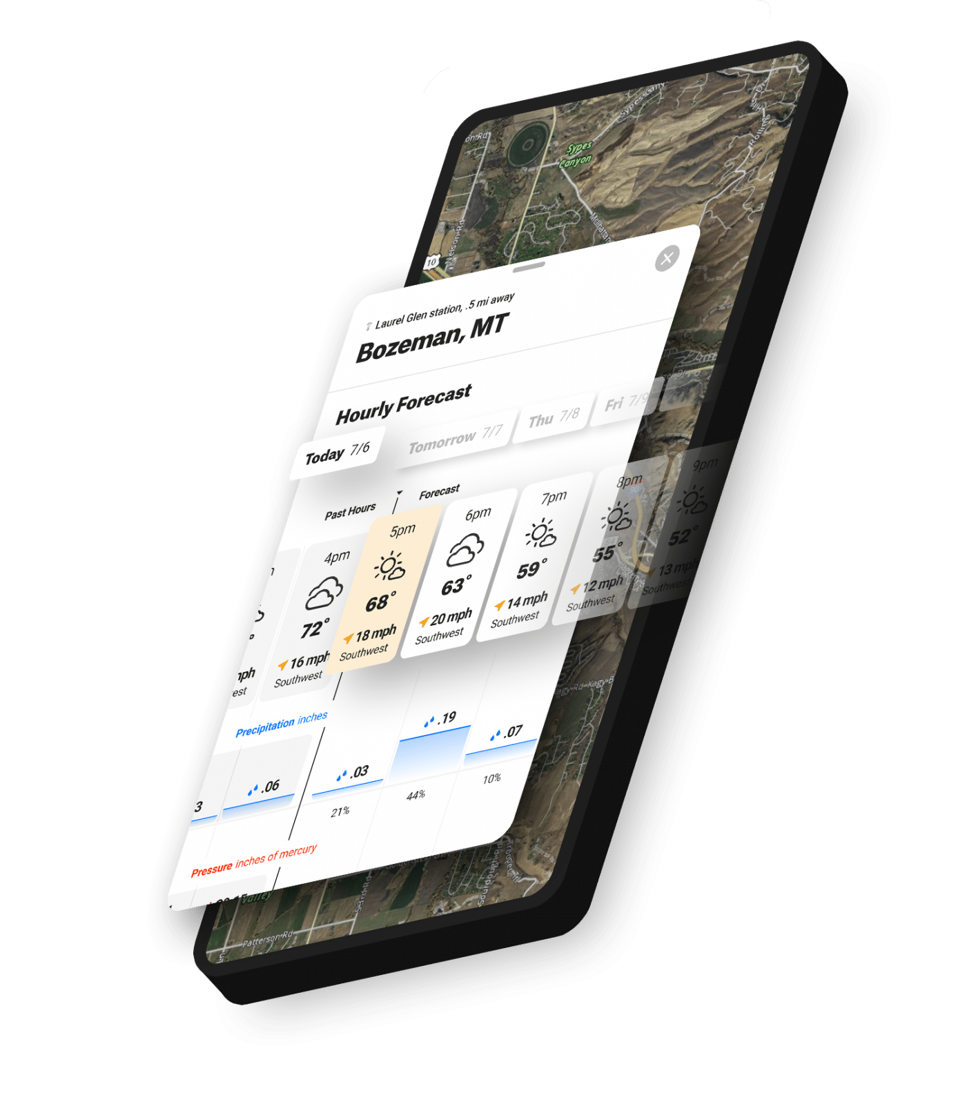

Wind Data, Right in the Hunt App
See an hour-by-hour forecast for wind speed and direction for the next eight days at any spot on your map. Know how wind direction might change by the hour, if barometric pressure is rising or falling, or if the rain will worsen or turn into a drizzle so you can adjust your tactics based on current and forecasted conditions.
Navigation Tools: Tracker and Compass
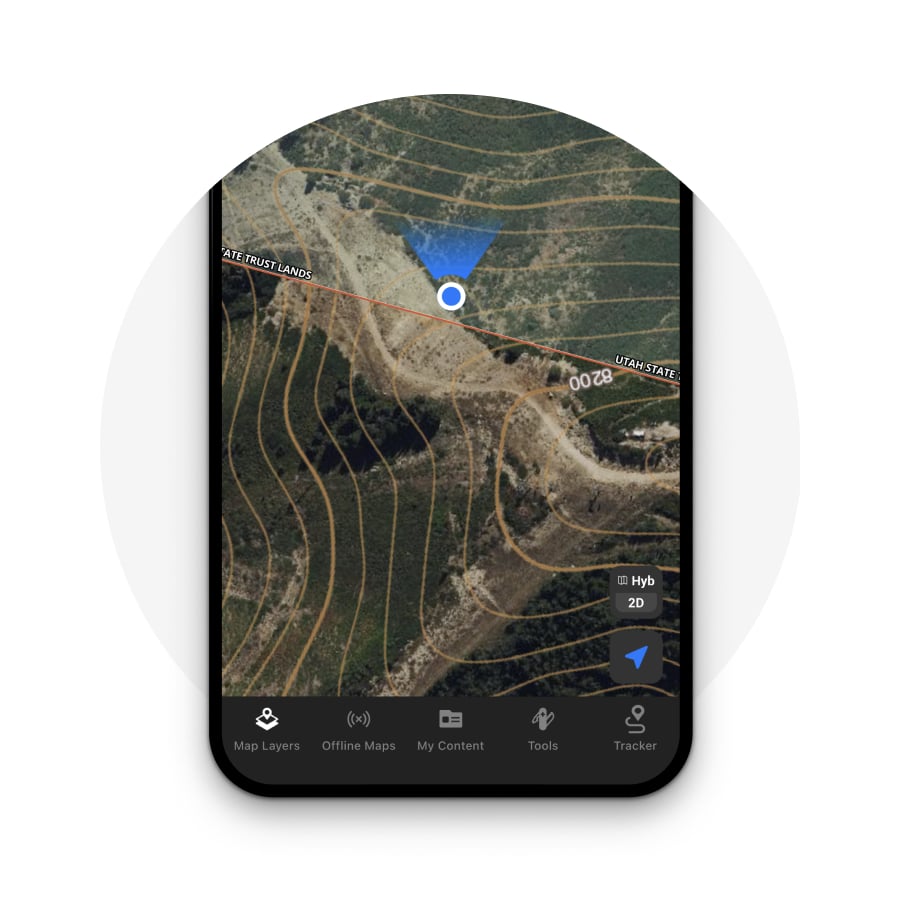

Compass in the Hunt App
Use the compass right in the onX Hunt App to find your location and orient yourself. Give the Location Button on the bottom right corner of the App one tap to center the map on your current physical location, tap twice to rotate the map in the direction you’re facing, and tap three times to rotate the map back to a north-up orientation.
![]()
Use Tracker to Mark Your Trail
The Tracker feature allows you to record your path as you travel and saves it on your map, taking the guesswork out of backtracking so you can have the confidence to explore the unknown. You’ll also see the time the trip took, as well as distance and average speed. This data is saved along with the Track and can be viewed in the My Content menu.
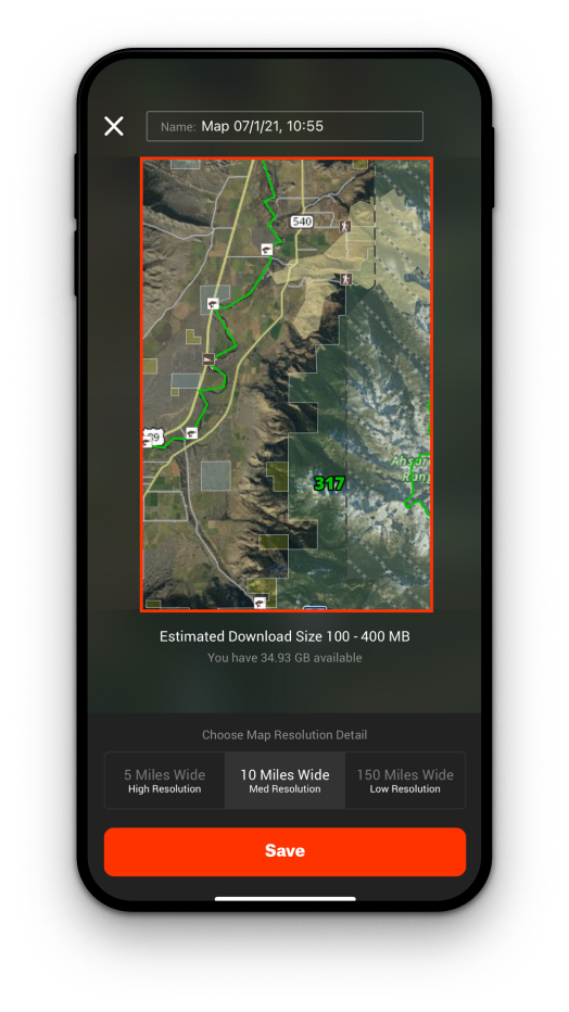
Offline Maps
No Cell Service Required
When to Use Offline Maps
Save an Offline Map before any trip into the field—even areas with widespread cell coverage may have small pockets in which service may drop off. In the event that you find yourself in an area with spotty or nonexistent cell service, you’ll still have access to your map.
Offline Maps 101
Quickly and easily download maps to your phone before heading into the field. Offline Maps are easy to update and sync to your account as soon as you return to service. Your live location information is based on your phone’s built-in GPS, so you’ll see a blue dot on the screen telling you exactly where you are at all times.
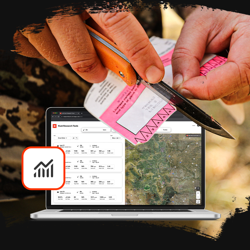
Research. Draw. Hunt.
Hunt Research Tools is designed to help hunters research, plan, and apply for hunts and tags every year.
- Build a successful strategy with easy-to-understand, accurate data
- Covers all 12 Western states and all major big game species
- Simple and powerful filtering sorts answers quickly
- Compare across states, species, weapons, dates, and hunt types
- Free with onX