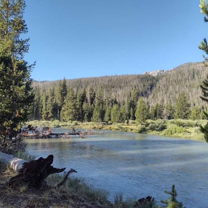
Near Highline #7094
An August frost blankets the hills around Lower Green River Lake & Squaretop from the Highline Trail
Near Highline #7094
Lower Green River Lake. Squaretop Mountain, 11,695 ft., is in the distance to the south, center-left.
Near Highline #7094
The Green River between Upper and Lower Green River Lakes.
Near Highline #7094
Big Sheep Mountain, 11,618 ft., impressively rises from the west shore of Lower Green River Lake.
Near Highline #7094
Clear Creek on its way to Lower Green River Lake.

Looking for more photos?

View All Photos
Driving Directions
Hike Trail

Highline #7094

5.0 (1 Rating)
Visit the forests, meadows, lakes, creeks, rivers, and high passes of the Wind River Range, close up to its high peaks.
108.7
mi
Distance
14,555
ft
Gain
moderate
Difficulty
Commonly BackpackedLakeRiver/CreekViewsWildflowersWildlife
Access Issues
USFS rules, please: - camp at least 200 feet away from lakes, creeks, and trails. - leash dogs in crowded areas - follow Leave No Trace Principles

Route Details

Flatter
Steeper
108.72mi
Distance
14,555ft
Elevation Gain
14,387ft
Elevation Loss
40%
Max Grade
11,111ft
High Point
7,970ft
Low Point
Path Type
Point to Point
Description
Trail Start to Lake Vera/North Fork Lake (Mile 0 - 23) Lake Vera/North Fork Lake to Summit Lake(Mile 23 - 57) From Lake Vera, in thin, rocky woods, North Fork Lake soon comes into view. The trail crosses its outlet creek and veers left without actually going to North Fork Lake. Still in thin, rocky woods, the trail is flat as it passes many lakes. For a stretch it follows and crosses Fall Creek a few times between Horseshoe Lake and Barnes Lake. After Barnes Lake the trail emerges from the forest to go through meadows and trees as it reaches Pole Creek. Pole Creek is crossed several times as the trail climbs upstream to join the CDT at mile mark 41, for the rest of its journey. The next 16 miles to Summit Lake is the highest section of Highline Trail. In rocky, grassy meadows, passing lakes, the trail goes over Lester Pass, veers west just before Shannon Pass, and descends into forest. Here in the forest, it crosses the upper reaches of Pine Creek, and then climbs to Summit Lake, once again in rocky, grassy meadows. Summit Lake to Trail End(Mile 57 - 113)

Route Conditions

Report Conditions
No Condition Reports
Report Conditions

Nearby Hike Routes

Cirque of the Towers Out and Back

Classic Hike Route

Cirque of the Towers Out and Back

Birding
strenuous
7.9 mi
+2,172 ft
Temple Lake Out and Back

Hike Route

Temple Lake Out and Back

Commonly Backpacked
strenuous
15 mi
+1,895 ft
Washakie - Hailey Pass Loop

Hike Route

Washakie - Hailey Pass Loop

Commonly Backpacked
strenuous
34.56 mi
+5,706 ft
Wind River High Route: Section 2

Hike Route

Wind River High Route: Section 2

Lake
extreme
19.19 mi
+5,733 ft
Continental Divide Trail: Cirque of the Towers Alternate (Part 2)

Hike Route

Continental Divide Trail: Cirque of the Towers Alternate (Part 2)

Lake
strenuous
10.17 mi
+2,843 ft
Cirque of the Towers: Two Pass Loop

Hike Route

Cirque of the Towers: Two Pass Loop

Commonly Backpacked
strenuous
23.44 mi
+3,979 ft
Contributors
Joan Pendleton
