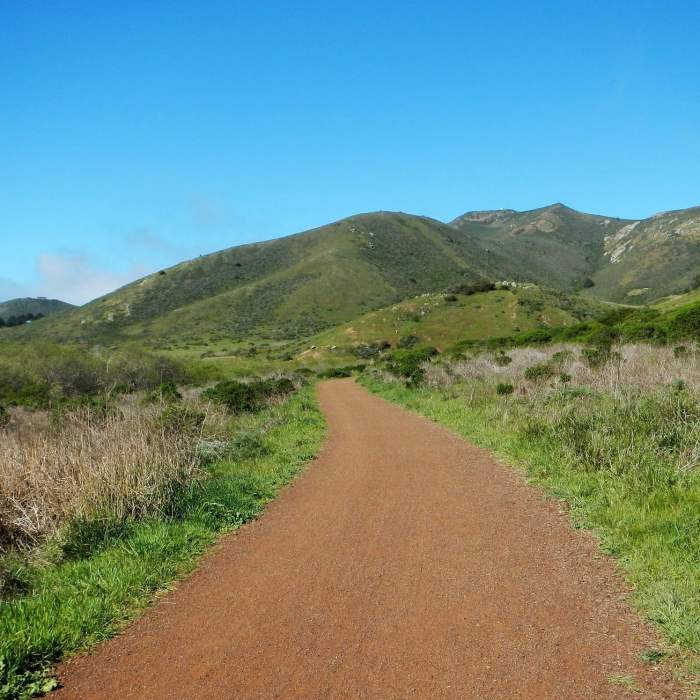
Near Rodeo Valley Trail
On the flats, slight breeze, plenty of sunshine today.

Looking for more photos?

View All Photos
View Map
Driving Directions
Hike Trail

Rodeo Valley Trail

3.5 (4 Ratings)
An open trail, featuring open sky and valley views.
1.1
mi
Distance
ft
Gain
easy
Difficulty
Family FriendlyRiver/CreekViewsWildflowers

Route Details

Flatter
Steeper
1.11mi
Distance
0ft
Elevation Gain
151ft
Elevation Loss
20%
Max Grade
194ft
High Point
43ft
Low Point
Path Type
Point to Point
Description
From the upper parking lot, this is a nice strolling trail that extends all the way down to the end of the Gerbode Valley. Along the way, you'll be working your way through the valley floor in an open meadow in parts and then along the creek in others. Look up and you'll see plenty of birds floating above. It is a major connector trail for mountain bikers and pedestrians of all sorts, so be on the look out, and be courteous to your fellow trail users.

Route Conditions

Report Conditions
No Condition Reports
Report Conditions

Nearby Hike Routes

South Headlands Loop (Coast-Miwok-Alta)

Hike Route

South Headlands Loop (Coast-Miwok-Alta)

Spring
moderate
7.59 mi
+1,388 ft
Rodeo Valley Trail to Miwok Trail Loop

Hike Route

Rodeo Valley Trail to Miwok Trail Loop

Views
strenuous
11.57 mi
+2,011 ft
Rodeo Lagoon Loop

Hike Route

Rodeo Lagoon Loop

Birding
easy
3.32 mi
+144 ft
Golden Gate Bridge Overlook Out-and-Back

Hike Route

Golden Gate Bridge Overlook Out-and-Back

Family Friendly
moderate
5.44 mi
+1,090 ft
Fort Cronkhite Loop: Coastal, Wolf Ridge + Miwok Trails

Hike Route

Fort Cronkhite Loop: Coastal, Wolf Ridge + Miwok Trails

Dogs Allowed
moderate
5.25 mi
+1,141 ft
Coastal Trail, Rodeo Beach to Muir Beach

Hike Route

Coastal Trail, Rodeo Beach to Muir Beach

Views
extreme
11.97 mi
+3,373 ft
Contributors
Phil DiGirolamo
