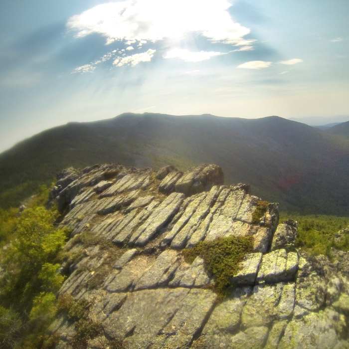
Near Center Ridge Trail
Looking down at the ponds from close to treeline on the Center Ridge Trail.
Near Center Ridge Trail
The Peak of Ridges with slanted slabs and the Traveler in the distance, sorry about the smudgy photo, I now carry a small cotton cloth with me to wipe away the grime and sweat before a photo :)

Looking for more photos?

View All Photos
View Map
Driving Directions
Hike Trail

Center Ridge Trail

5.0 (1 Rating)
Use this trail to head up to the Peak of Ridges and enjoy nice views of the ponds and The Traveler.
1.8
mi
Distance
2,092
ft
Gain
strenuous
Difficulty
Views

Route Details

Flatter
Steeper
1.79mi
Distance
2,092ft
Elevation Gain
0ft
Elevation Loss
50%
Max Grade
3,239ft
High Point
1,146ft
Low Point
Path Type
Point to Point
Description
The Center Ridge Trail is accessed from a trail intersection near the Upper South Branch Pond. This short, steep trail takes you up to the Peak of Ridges through steep semi-open ledges with tall Red pines. The wind through these trees is mesmerizing, so take your time to enjoy the sound. You'll get some stellar views and enter the alpine zone about one mile into this trail. Here things get more technical with many loose rocks. The Peak of Ridges, at 3 miles and 3254', has exposed and slanted rock slabs. This summit has real mountain terrain with 360 views. From here you descend into a smallish saddle and then head up to Traveler Mountain, where this trail ends with a junction with the Traveler Mountain Trail.

Route Conditions

Report Conditions
No Condition Reports
Report Conditions

Nearby Hike Routes

The Traveler and South Branch Mountain Loop

Hike Route

The Traveler and South Branch Mountain Loop

Lake
strenuous
12.97 mi
+5,520 ft
Russell Pond-Mount Katahdin Loop

Hike Route

Russell Pond-Mount Katahdin Loop

Birding
strenuous
19.22 mi
+5,344 ft
Wassataquoik Lake

Hike Route

Wassataquoik Lake

Birding
moderate
21.6 mi
+1,670 ft
Mt. Katahdin

Hike Route

Mt. Katahdin

Fall Colors
strenuous
9.05 mi
+4,127 ft
South Turner Mountain via Sandy Stream Pond

Hike Route

South Turner Mountain via Sandy Stream Pond

Lake
moderate
3.62 mi
+1,656 ft
Mount Katahdin via the Knife Edge + Hamlin Ridge Trails

Hike Route

Mount Katahdin via the Knife Edge + Hamlin Ridge Trails

Views
extreme
10.22 mi
+4,662 ft
Contributors
Bryan Gagner
