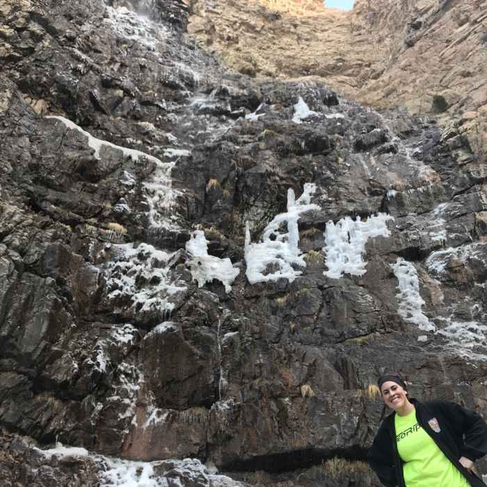
Near Waterfall Canyon Trail
Ice covered falls just starting to melt.

Looking for more photos?

View All Photos
View Map
Driving Directions
Hike Trail

Waterfall Canyon Trail

4.2 (21 Ratings)
A beautiful climb off the Bonneville Shoreline Trail following a small water run off up to small falls.
1.2
mi
Distance
1,073
ft
Gain
moderate
Difficulty
Dogs AllowedRiver/CreekViewsWaterfall

Route Details

Flatter
Steeper
1.17mi
Distance
1,073ft
Elevation Gain
0ft
Elevation Loss
60%
Max Grade
5,841ft
High Point
4,768ft
Low Point
Path Type
Point to Point
Description
The first half of the hike is on an easy graded hiking trail. Then you'll cross a small wooden bridge, and this is when you'll have to slow down as the trail surface changes to just rocks. The last 100 meters are a little steeper than before and are more muddy and wet but not too slick thanks to the high rock quantity. If hiking with a dog, the last 100 meters will slow you down since they will have to climb. The trail ends at a scenic waterfall. Note that it is possible to hike beyond the waterfall to Malan's Basin, if it is within your sphere of acceptable risk. Look for the path of least resistance and never climb up anything you wouldn't feel comfortable climbing back down.

Route Conditions

Report Conditions
Anonymous Adventurer
All Clear
Anonymous Adventurer
All Clear
Anonymous Adventurer
All Clear
Anonymous Adventurer
All Clear
Looking for more condition reports?
View History

Nearby Hike Routes

Waterfall Canyon - Malan's Waterfall

Hike Route

Waterfall Canyon - Malan's Waterfall

Dogs Allowed
easy
1.19 mi
+1,113 ft
Mt. Ogden

Hike Route

Mt. Ogden

Birding
strenuous
14.67 mi
+5,265 ft
Moose Trail Loop

Hike Route

Moose Trail Loop

easy
1.02 mi
+169 ft
Mt. Ogden from Snowbasin

Hike Route

Mt. Ogden from Snowbasin

Less Crowded
strenuous
4.81 mi
+3,162 ft
Wheeler - Icebox - Art Nord Loop

Hike Route

Wheeler - Icebox - Art Nord Loop

Fall Colors
moderate
4.13 mi
+872 ft
Middle Fork to Wheeler Creek to East Fork Loop

Hike Route

Middle Fork to Wheeler Creek to East Fork Loop

Fall Colors
moderate
6.44 mi
+965 ft
Contributors
Mike Duff
