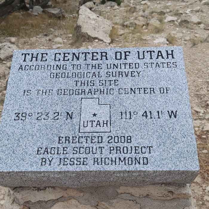
Near Geographical Center of Utah
Marker at the end of the Geographical Center of Utah Trail.

Looking for more photos?

View All Photos
Driving Directions
Hike Trail

Geographical Center of Utah

5.0 (1 Rating)
Short hike to the geographical center of Utah.
0.2
mi
Distance
182
ft
Gain
strenuous
Difficulty
Geologically SignificantViews

Route Details

Flatter
Steeper
0.19mi
Distance
182ft
Elevation Gain
0ft
Elevation Loss
15%
Max Grade
5,887ft
High Point
5,704ft
Low Point
Path Type
Point to Point
Description
To get to this hike, you have to drive on a public access road through private property. Be sure to close the gate behind you. The hike has a steep incline at the beginning and is relatively flat toward the end. The trail is marked by rock cairns.

Route Conditions

Report Conditions
No Condition Reports
Report Conditions

Nearby Hike Routes

Find more hikes near: Ephraim, UtahWales, UtahManti, Utah
Deer Run & Flume Trail Loop

Hike Route

Deer Run & Flume Trail Loop

River/Creek
moderate
4.43 mi
+902 ft
Bald Loop

Hike Route

Bald Loop

Views
strenuous
9.78 mi
+2,672 ft
Paul Bunyan's Woodpile

Hike Route

Paul Bunyan's Woodpile

Less Crowded
easy
0.74 mi
+514 ft
Grotto Falls Trail

Hike Route

Grotto Falls Trail

Fall Colors
moderate
0.58 mi
+139 ft
Rochester Rock Art Panel

Hike Route

Rochester Rock Art Panel

Historical
moderate
0.65 mi
+121 ft
Spanish Fork River Trail

Hike Route

Spanish Fork River Trail

Views
easy
4.31 mi
+43 ft
Contributors
Matthew D
