Near Airport Runway
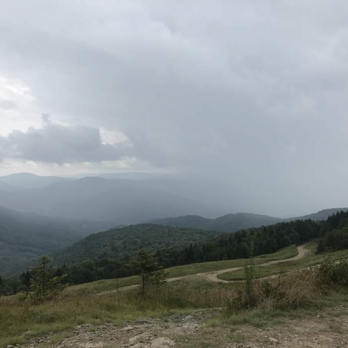
Airport Runway head wall, with clouds in the valley.

Looking for more photos?

View All Photos
Driving Directions
Hike Trail

Airport Runway

5.0 (1 Rating)
A trail through high alpine meadows with a spectacular view.
1.6
mi
Distance
231
ft
Gain
easy
Difficulty
Views
Access Issues
This is a multi-use trail, be alert for mountain bikers or vehicle traffic.

Route Details

Flatter
Steeper
1.61mi
Distance
231ft
Elevation Gain
413ft
Elevation Loss
20%
Max Grade
4,845ft
High Point
4,462ft
Low Point
Path Type
Point to Point
Description
This trail is most easily accessed by climbing Airport Road. Once you are on the Airport Runway trail, take a break and soak in the beauty of the flora and fauna and the spectacular views. This trail accesses the head of Upper Beaver Dam in the west corner of the meadow. If you head northeast up the headwall, the trail eventually punches out of the forest at the summit of the Silver Creek Ski Area. Before starting this hike, stop by the Mountain Adventure Center in the village for trail updates and a backcountry hiking/biking map.

Route Conditions

Report Conditions
No Condition Reports
Report Conditions

Nearby Hike Routes

Cranberry Wilderness Loop

Hike Route

Cranberry Wilderness Loop

Cave
strenuous
16.56 mi
+2,022 ft
Upshur County Trails

Hike Route

Upshur County Trails

Birding
moderate
4.97 mi
+667 ft
Ramsey's Draft Loop

Hike Route

Ramsey's Draft Loop

Commonly Backpacked
moderate
15.7 mi
+3,019 ft
Blue Suck Falls Loop

Hike Route

Blue Suck Falls Loop

Fall Colors
moderate
8.66 mi
+2,032 ft
Beards Mountain Loop

Hike Route

Beards Mountain Loop

Fall Colors
moderate
6.2 mi
+1,509 ft
Snarkley Route

Hike Route

Snarkley Route

extreme
26.71 mi
+12,335 ft
Contributors
Shane Bradley
