Near Waldron
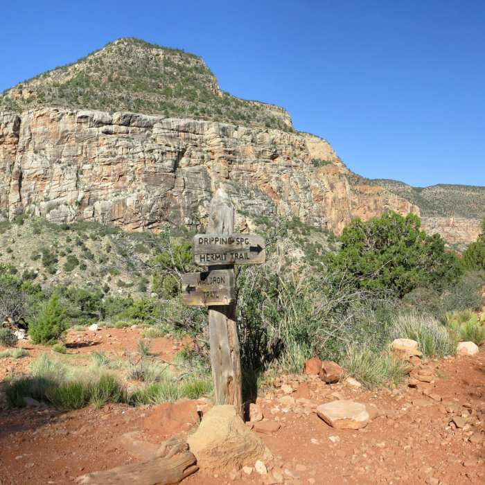
Junction of Hermit Trail and Waldron Trail (NPS photo by Michael Quinn)
Near Waldron
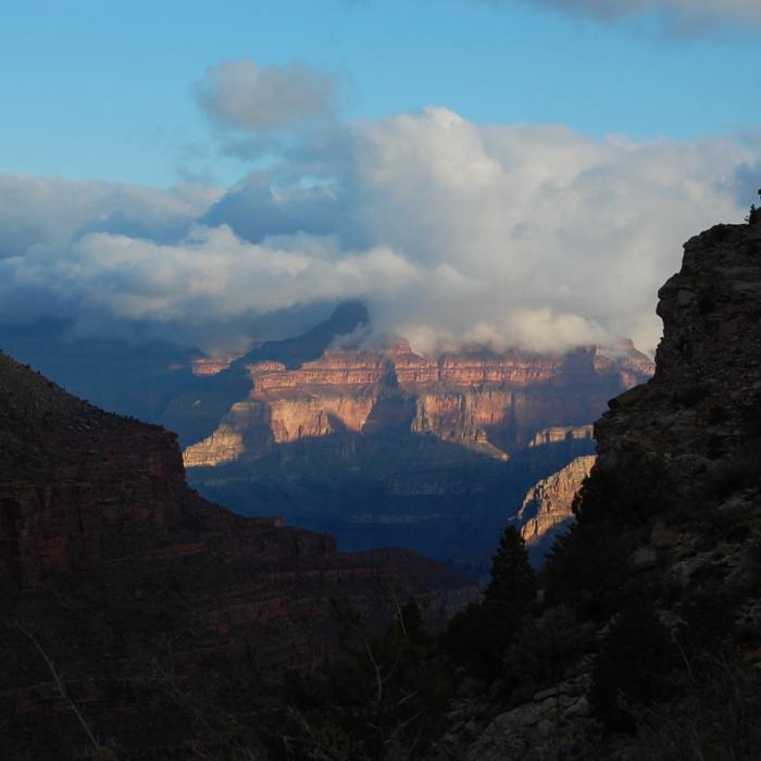
Wonderful canyon views through this cut in the rim

Looking for more photos?

View All Photos
Driving Directions
Hike Trail

Waldron

3.0 (2 Ratings)
This is a connector between the rim's forest roads near Horsethief Tank and the Hermit Basin trails.
3.8
mi
Distance
110
ft
Gain
strenuous
Difficulty
Less CrowdedViewsWildflowers

Route Details

Flatter
Steeper
3.85mi
Distance
110ft
Elevation Gain
1,409ft
Elevation Loss
50%
Max Grade
6,716ft
High Point
5,344ft
Low Point
Path Type
Point to Point
Description
This remote, infrequently used route connects the forest roads south of Hermit's Rest to the Hermit Trail and Dripping Springs trails. Depending on how far you want to drive your car on the dirt roads past Rowe Well Road, you can park closer to Horsethief Tank and begin the trail at a gate. The Waldron Trail is attractive for Grand Canyon aficionados who crave solitude and want to access Hermit Basin using a trail that is gentler on the knees than Hermit Trail. From the gate, follow the road over a wooded plateau for about 3/4 of a mile to the trailhead for Waldron. Here, take the right-hand fork and descend gently to Horsethief Tank. The views improve as you approach the rim. Switchback steeply down about 1000 feet through the Coconino and Toroweap layers and finally arrive at the flatter terrain of Hermit Basin. After passing through more scrub, the trail ends at the junction with Hermit Trail. Take in the views of !Hermit Creek from nearby cliffs.

Route Conditions

Report Conditions
No Condition Reports
Report Conditions

Nearby Hike Routes

Hermit Trail

Hike Route

Hermit Trail

Birding
strenuous
34.33 mi
+12,265 ft
Dripping Springs

Hike Route

Dripping Springs

Views
strenuous
5.99 mi
+2,244 ft
Hermit Loop

Hike Route

Hermit Loop

Views
extreme
67.88 mi
+12,631 ft
Hermit's Rest to Waldron

Hike Route

Hermit's Rest to Waldron

Less Crowded
strenuous
6.52 mi
+2,483 ft
Rim Trail to Mohave Point

Classic Hike Route

Rim Trail to Mohave Point

Birding
easy
5.93 mi
+413 ft
Rim-to-River via Bright Angel

Hike Route

Rim-to-River via Bright Angel

Fall Colors
strenuous
15.67 mi
+5,085 ft
Contributors
Megan W
