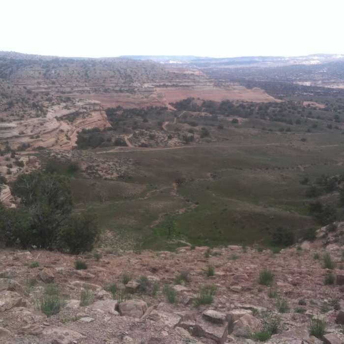
Near Rabbit Valley Doubletrack
Looking down from the ridge at trail #8.

Looking for more photos?

View All Photos
Driving Directions
Hike Trail

Rabbit Valley Doubletrack

2.0 (1 Rating)
A rocky descent to a sandy bottom doubletrack access to Rabbit Valley 8.
1.2
mi
Distance
28
ft
Gain
strenuous
Difficulty
Views

Route Details

Flatter
Steeper
1.19mi
Distance
28ft
Elevation Gain
278ft
Elevation Loss
15%
Max Grade
4,924ft
High Point
4,671ft
Low Point
Path Type
Point to Point
Description
The access road begins on the Kokopelli Trail in Rabbit Valley. The portion shown here is that segment used to access the Rabbit Valley 8 and the Rabbit Valley #4/8/3 Rim Loop. The descent into the valley is a bit rugged and makes for a tough finish to the Rabbit Valley 8 loop. At the southern terminus of the doubletrack, just south of the Rabbit Valley 8 intersection, is a great viewpoint of Black Rocks in the Moore Canyon Area along the Colorado River. If hiking the Rabbit Valley 8, it is well worth the short out and back to this viewpoint.

Route Conditions

Report Conditions
No Condition Reports
Report Conditions

Nearby Hike Routes

Jouflas Loop

Classic Hike Route

Jouflas Loop

River/Creek
moderate
7.63 mi
+737 ft
Trail Through Time

Classic Hike Route

Trail Through Time

ADA Accessible
moderate
1.52 mi
+159 ft
Rabbit's Ear

Hike Route

Rabbit's Ear

Family Friendly
moderate
7.5 mi
+1,008 ft
Rustler's Loop

Classic Hike Route

Rustler's Loop

Geologically Significant
easy
3.55 mi
+219 ft
Kokopelli Trail

Hike Route

Kokopelli Trail

Views
strenuous
138.98 mi
+15,441 ft
Rattlesnake Canyon Arches

Hike Route

Rattlesnake Canyon Arches

Less Crowded
easy
2.66 mi
+150 ft
Contributors
D L
