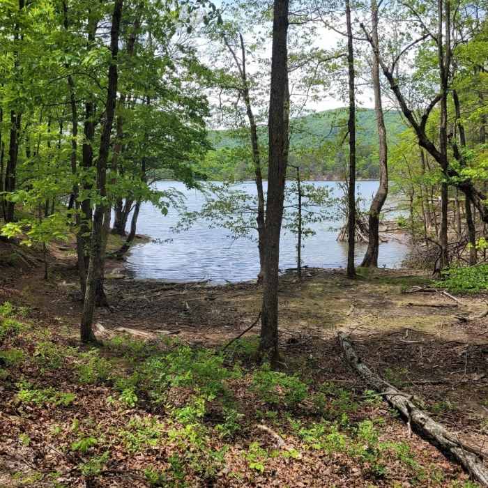
Near Tinker Creek Trail
Carvins Cove Reservoir from Tinker Creek Trail (5/9)

Looking for more photos?

View All Photos
Driving Directions
Hike Trail

Tinker Creek Trail

5.0 (1 Rating)
Well-traveled trek through forest that opens up to gorgeous reservoir views!
2.4
mi
Distance
392
ft
Gain
moderate
Difficulty
Fall ColorsLakeRiver/CreekViewsWildflowersWildlife
Access Issues
Day-Use access passes ($7/vehicle) are required for recreation within the Carvins Cove Reservoir.

Route Details

Flatter
Steeper
2.36mi
Distance
392ft
Elevation Gain
274ft
Elevation Loss
30%
Max Grade
1,413ft
High Point
1,054ft
Low Point
Path Type
Point to Point
Description
This hike starts by tracking through the forest along Tinker Creek. Easy Street, a small picnic area, is accessible about a quarter mile in from the main trail. Please be sure to stay on track during the first half of the hike - it travels through private property. Emerge from the forest to hike under the power line right of way for a short while until the ridge is crested. Elevation changes the most both before and after the ridge crest, so take your time if needed! After cresting the ridge, the trail follows the reservoir border down to the Carvins Cove docks. All along this side of the ridge are views of crystal clear blue water and rolling mountains!

Route Conditions

Report Conditions
No Condition Reports
Report Conditions

Nearby Hike Routes

Carvins Cove Route

Hike Route

Carvins Cove Route

Fall Colors
moderate
12.19 mi
+1,631 ft
McAfee Knob

Hike Route

McAfee Knob

Birding
strenuous
7.8 mi
+1,630 ft
McAfee Knob

Hike Route

McAfee Knob

Less Crowded
moderate
3.96 mi
+1,554 ft
Mill Mountain Park Loop

Hike Route

Mill Mountain Park Loop

Views
strenuous
7.74 mi
+1,424 ft
Virginia's Triple Crown Loop

Hike Route

Virginia's Triple Crown Loop

Commonly Backpacked
strenuous
30.51 mi
+7,554 ft
Dragon's Tooth via the Appalachian Trail

Hike Route

Dragon's Tooth via the Appalachian Trail

Less Crowded
moderate
2.39 mi
+1,400 ft
Contributors
Cristin Dolan
