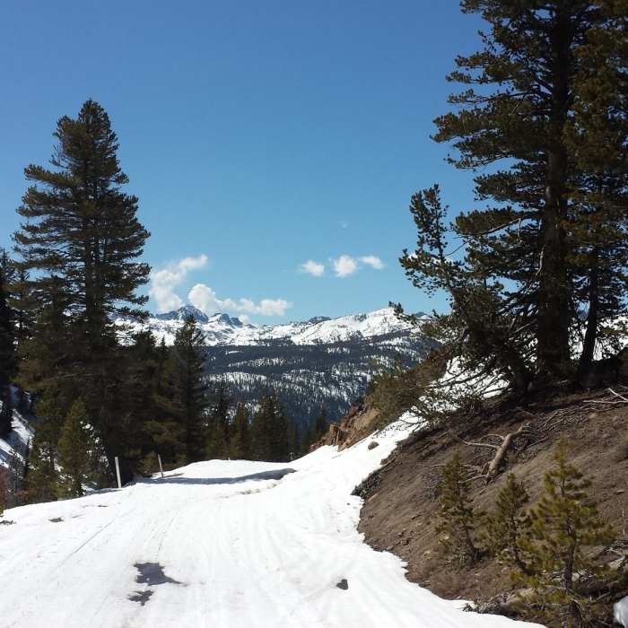
Near Starkweather Lake Trail
Such a beauty to behold in the winter! Postpile Road closed to vehicles (but not foot traffic) in the winter.

Looking for more photos?

View All Photos
View Map
Driving Directions
Hike Trail

Starkweather Lake Trail

4.5 (2 Ratings)
A sweet singletrack trail from Minaret Summit to Starkweather Lake. A true Mammoth gem.
2.5
mi
Distance
55
ft
Gain
moderate
Difficulty
LakeViews

Route Details

Flatter
Steeper
2.47mi
Distance
55ft
Elevation Gain
1,198ft
Elevation Loss
30%
Max Grade
9,175ft
High Point
8,028ft
Low Point
Path Type
Point to Point
Description
The descent down to Starkweather Lake is one of the best sections of singletrack in the area. It's 2.5 miles of rolling trail, winding through the woods. The climb back up is grueling and unrelenting. Directions are not really necessary here as there are no trail intersections. Just take Starkweather Trail all the way down to the lake. There are a few small creek crossings, switchbacks, and a couple mildly technical sections to keep your speed in check. The dirt is mostly packed with some looser pumice spots sprinkled around. Getting to the trailhead: From town, drive up Highway 203 towards Main Lodge of Mammoth Mountain Ski Area. Continue past Main Lodge and go all the way up to the turnoff for Minaret Vista (just before the Forest Service kiosk to go down to Reds Meadow). Make a right for Minaret Vista, and then another quick right and park in the dirt lot. Hike back to Highway 203 and cross the road at Forest Service kiosk. The trailhead is right next to the kiosk, and youll see the sign a few feet up the hill.

Route Conditions

Report Conditions
No Condition Reports
Report Conditions

Nearby Hike Routes

Sotcher Lake

Hike Route

Sotcher Lake

Lake
easy
1.4 mi
+121 ft
Devils Postpile Short Loop

Classic Hike Route

Devils Postpile Short Loop

ADA Accessible
moderate
1.23 mi
+230 ft
Devils Postpile to Superior Lake

Hike Route

Devils Postpile to Superior Lake

Lake
strenuous
7.39 mi
+2,431 ft
Minaret Creek Trail

Hike Route

Minaret Creek Trail

Birding
strenuous
14.29 mi
+2,511 ft
Devil's Postpile to Shadow Creek Trail

Hike Route

Devil's Postpile to Shadow Creek Trail

Lake
extreme
21.01 mi
+4,252 ft
Agnew Meadow to Lower Rainbow Falls (JMT Route)

Hike Route

Agnew Meadow to Lower Rainbow Falls (JMT Route)

Waterfall
moderate
19.28 mi
+2,250 ft
Contributors
Eric Hunter
