Near Perk Ridge Trail (T92) Access from Cedar Creek Dispersed Camping Area
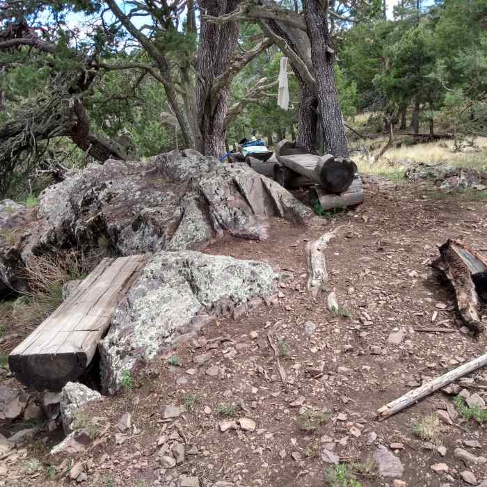
Log benches provide a welcoming place for lunch after the trail ascends the walls of Cedar Creek Canyon.
Near Perk Ridge Trail (T92) Access from Cedar Creek Dispersed Camping Area
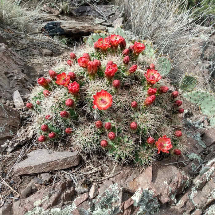
Mountain Ball Cactus in bloom.

Looking for more photos?

View All Photos
Driving Directions
Hike Trail

Perk Ridge Trail (T92) Access from Cedar Creek Dispersed Camping Area

4.0 (1 Rating)
Alternative access point to Perk Ridge Trail (T92) from the Cedar Creek Dispersed Camping Area
1.8
mi
Distance
630
ft
Gain
moderate
Difficulty
Fall ColorsViews

Route Details

Flatter
Steeper
1.8mi
Distance
630ft
Elevation Gain
185ft
Elevation Loss
35%
Max Grade
7,989ft
High Point
7,472ft
Low Point
Path Type
Point to Point
Description
This description is of an alternative starting point for the Perk Ridge Trail, T92. The primary access point for T92 is off Thunderbird Drive in the city of Ruidoso. This alternative starting point doesn't show on the current Lincoln NF map, but it is signed, well-marked, and easy to follow. The Cedar Creek Dispersed Camping Area has a small cul-de-sac at the end of Cedar Creek Road (FR 88); park here. A sign at the end of the cul-de-sac indicates the starting point of the trail (T92). The trail begins heading northwest, switchbacks to the southeast, and then several more times as it ascends the walls of Cedar Creek canyon, bearing generally southeast and then south. The trail stays just east of the boundary of the Mescalero Apache Reservation and passes through stands of Gambel Oak and Mountain Maple. The ending point for this trail description occurs at a scenic overlook with a few log benches (views to the Northeast toward Alpine Village, Mills Peak, and Alto). The trail appears to be popular with mountain bike or trail bike users.

Route Conditions

Report Conditions
No Condition Reports
Report Conditions

Nearby Hike Routes

Petroglyph Trail

Hike Route

Petroglyph Trail

Dogs Allowed
easy
1.84 mi
+230 ft
Malpais Nature Trail

Hike Route

Malpais Nature Trail

Views
easy
1 mi
+54 ft
Rim Trail Out-and-Back

Hike Route

Rim Trail Out-and-Back

Birding
strenuous
22.59 mi
+3,671 ft
Fresnal Canyon Rails-to-Trails

Hike Route

Fresnal Canyon Rails-to-Trails

Family Friendly
moderate
8.74 mi
+1,000 ft
Alamo Canyon Loop

Hike Route

Alamo Canyon Loop

River/Creek
strenuous
5.69 mi
+1,277 ft
Alkali Flat Trail

Hike Route

Alkali Flat Trail

Views
moderate
4.61 mi
+279 ft
Contributors
Scott McMullen
