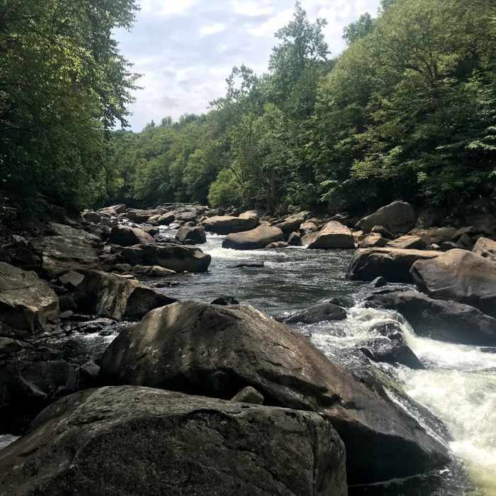
Near Kendall Trail
View at the end of the hike, area of rapids called National Falls.

Looking for more photos?

View All Photos
View Map
Driving Directions
Hike Trail

Kendall Trail

4.0 (2 Ratings)
Nice hike along a flowing river.
5.2
mi
Distance
560
ft
Gain
moderate
Difficulty
Family FriendlyHistoricalLess CrowdedRiver/CreekWildlife
Access Issues
No parking at trailhead.

Route Details

Flatter
Steeper
5.22mi
Distance
560ft
Elevation Gain
240ft
Elevation Loss
30%
Max Grade
1,830ft
High Point
1,486ft
Low Point
Path Type
Point to Point
Description
Very easy hike for the first 2 miles -- flat and well maintained. Significantly muddy stretch intermittently for 0.25-5 miles around mile 2.5. There is supposed to be an abandoned town around mile marker 2, but it's too overgrown to see anything. Pushing forward, the trail becomes more rocky and has several small stream crossings towards the end. There are some lovely areas of rapids to enjoy hiking past. The trail ends rather abruptly around 5.5 miles in. Just beyond the end of the visible trail, there is an area called National Falls, a portion of rapids on the river. We found some nice rocks to sit on to enjoy lunch then headed back. Most people turn back after a couple of miles, so we enjoyed the majority of the hike without seeing other hikers.

Route Conditions

Report Conditions
No Condition Reports
Report Conditions

Nearby Hike Routes

Fork Run Loop

Hike Route

Fork Run Loop

River/Creek
moderate
7.65 mi
+964 ft
Meadow Mountain Trail

Hike Route

Meadow Mountain Trail

Birding
moderate
4.45 mi
+643 ft
Beckman Trail

Hike Route

Beckman Trail

Lake
easy
3.27 mi
+345 ft
Sugarloaf Sled Hill to Falls Overlook

Hike Route

Sugarloaf Sled Hill to Falls Overlook

Fall Colors
moderate
4.54 mi
+148 ft
Cucumber Falls

Hike Route

Cucumber Falls

Views
easy
1.01 mi
+124 ft
Laurel Highlands Trail: Ohiopyle State Park

Hike Route

Laurel Highlands Trail: Ohiopyle State Park

Fall Colors
strenuous
10.76 mi
+2,820 ft
Contributors
Rachel L
