
Free 3-Month onX Fish Membership
Currently Available in Minnesota, Wisconsin, Michigan, North Dakota, Ohio and Indiana. More states to come.
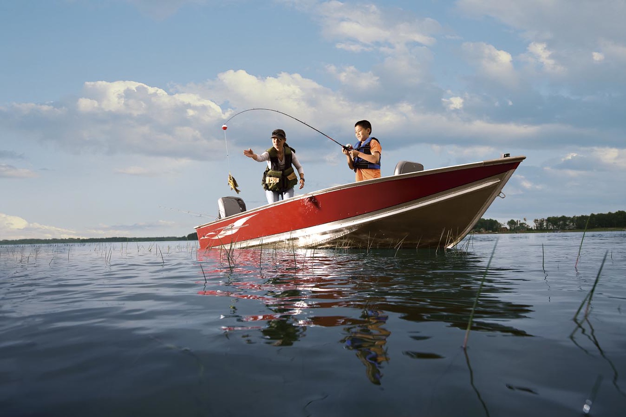
Find Your Next Fishing Spot
Try onX Fish in Minnesota, Wisconsin, Michigan, North Dakota, and Indiana. We are excited to provide you with the most comprehensive fishing tool for increasing your confidence on the water. For many years, the best and smartest anglers have utilized fisheries data to put them in the right place at the right time. onX Fish provides fishermen with customizable filters to highlight fish species and sizes of interest, all while offering multiple “plan B’s” at their fingertips.
onX Fish will help you find new opportunities you never knew existed. Our goal is to give you all the information you need to confidently plan your next fishing trip, get to the access point, and then find your target fish successfully with unique map tools and layers.
Plan: Find a New Place To Fish
- Lake and Species Filtering
- Species Abundance, Trophy, and Keeper Potential
- Fishing HotSpots
- Regulations
Go: Get to the Lake
- Public/private land ownership data
- Lake access points, navigation, Apple Carplay
- Points of interest (camping, bait, gas)
- Roads and trails
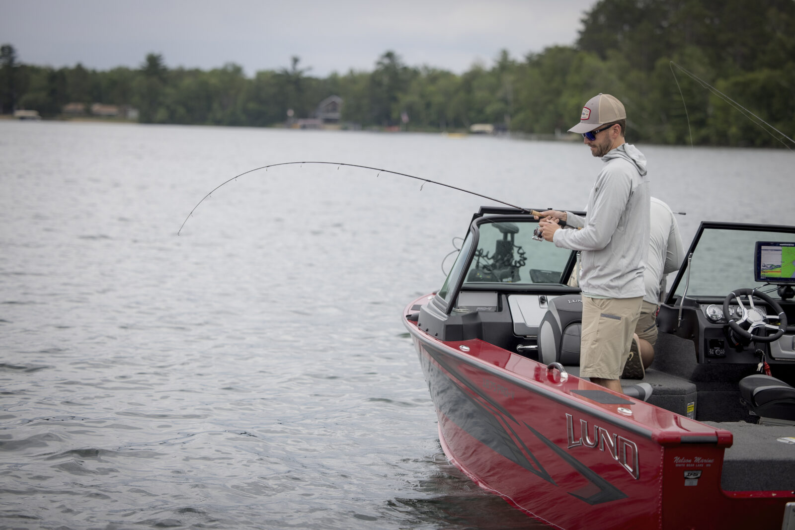
Fish: On the Lake
- Mark, customize, and share Waypoints
- Lake Depth Contours
- Aerial Imagery (both Recent and High Resolution)
- Weather reports and forecasting

Find New Lakes To Fish
Plan your fishing day using curated data and tools within the onX Fish App. Find which species live in which body of water, boat ramps and access points, fishing regs, current weather conditions, and more—all in one place.

Plan Your Day Using Access and Amenities Information
Easily find waterbody access information and details on nearby amenities. Go into your day with a plan, knowing how to get on the water and what to expect once you’re at the boat ramp or access trail.

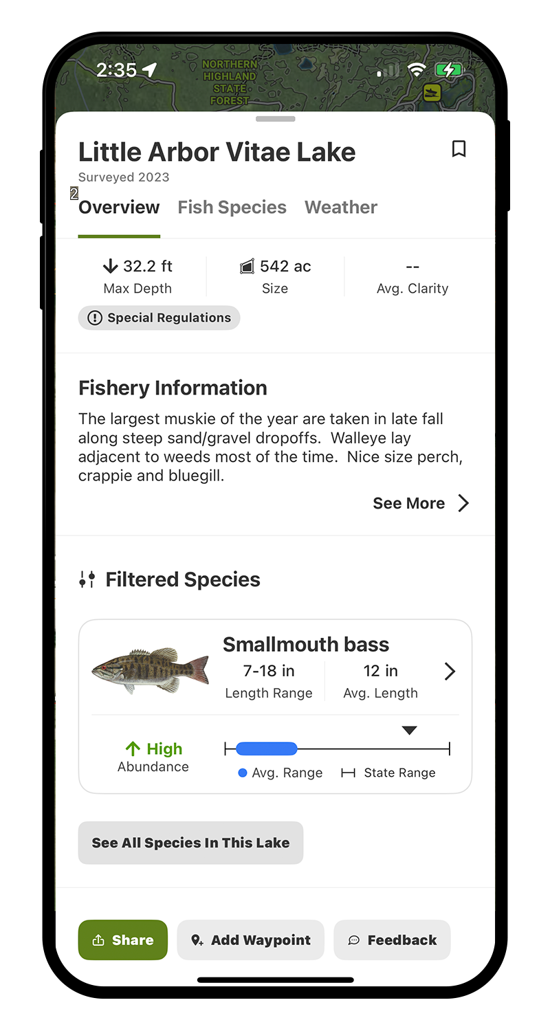
Identify Species of Interest—Then Filter for Trophy Fish, Keeper Potential, or High Abundance
onX makes finding the fish you want to catch easier than ever before. Select up to several species, as well as multiple characteristics for size and abundance to find nearby lakes that hold what you’re after.

Know What To Expect With Fish Species Size Distribution Survey Data
Put the odds in your favor by knowing your target species before hitting the water. In the onX Fish App, you’ll be able to see detailed population graphics, including CPUE, relative abundance, and all of the surveys for that lake that have ever been completed—all at your fingertips.

Private and Public Land Parcels Around Water Bodies
Our public and private land boundaries will help you identify public access points and avoid crossing onto private land. Ensure that you are accessing legally and making the most of your public land opportunities.

Build Tactics Using Tools Such as Recent Imagery, Lake Contours, Weather, and More
Plan your fishing day using curated data and tools within the app. Use contour lines to help you visualize and understand lake bottom, so you can determine what structure fish may be holding on. Explore current and forecasted conditions, wind speeds, barometer, lunar phase, and more to help determine the best time to hit the water.
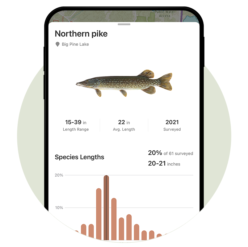
Survey Data With Species Size Distribution
Understand the size class of fish in your selected body of water to determine trophy potential and tactics for your target species.
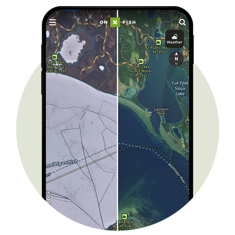
Recent Satellite Imagery
Visualize current conditions such as current ice coverage, lake levels, and more with Recent Imagery updated every two weeks with historical look-back available to March 2023.
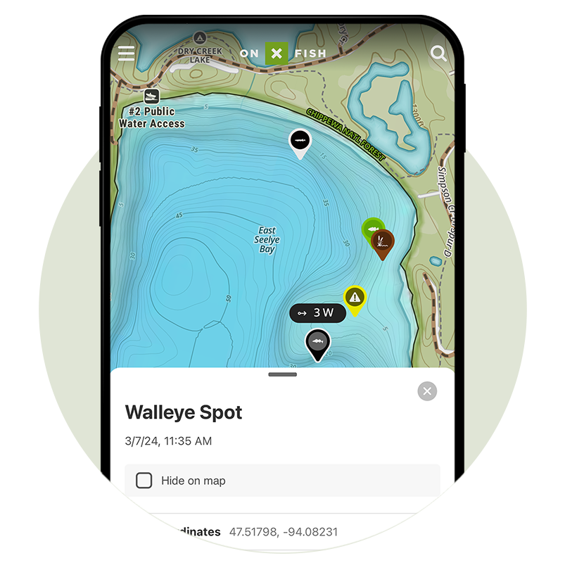
Mark and Customize Waypoints
Mark productive fishing spots, cover, and structure with a Waypoint, then customize the Waypoint with color, photos, notes, and more. Keep track of wind conditions at each Waypoint so you can plan your fishing day accordingly.
Use Tracker to Mark Your Path
The onX Fish Tracker records your path as you travel and saves your track on the map as a blue-dashed line. Look back at the area you’ve covered, miles traveled, and more. The Tracker also provides information about your trip duration, distance, and average speed. Create a safe track on ice and open water, then return back along the same route.