Ready to explore this trail?
View Trail Map in AppThe portions of the trail are snow-covered until early July. The last mile of the trail to the summit skirts the Gallatin Bear Management Area; no off-trail travel is permitted north of the summit May 1 to November 10. Plan to summit before noon. Afternoon thunderstorms are common. You should not be exposed anywhere above treeline when one hits!
Path Type
There and Back
This strenuous out-and-back trail begins on the Mammoth to Norris Road south of Indian Creek Campground. The trail heads northwest over rolling terrain. The entire area that this trail traverses was heavily burned in the 1988 fires. At 1.1 miles, the trail crosses Winter Creek; if you want to keep your feet dry, look for a log jam up stream. Just past the ford, the trail turns left and follows Winter Creek for the next 4.7 miles through a neat little narrow valley. Look for moose and elk along this section of the trail.
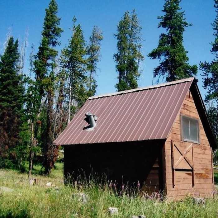
At 2.6 miles, you pass a trail junction (on the left) with the Grizzly Lake Trail. Here Straight Creek (the Grizzly Lake outlet) joins with Winter Creek. Both creeks sport a nice population of brook trout. At the 5.8-mile mark, the trail reaches the Winter Creek Patrol Cabin. Nearby are several backcountry campsites. There is also a trail junction here with the Trilobite Lake Trail (the trail up to the lake leads to the northwest from the rear of the patrol cabin).
The Mount Holmes Trail continues past the cabin, leaves the Winter Creek drainage, and quickly begins to climb. The trail gains more than 2,600 feet in the last 5.4 miles, starting slowly and becoming steeper as you near the top. Mount Holmes was named for geologist/topographer William Holmes, who in 1878 wrote the first detailed geological report on Yellowstone. Mount Homes is the southern terminus of the Gallatin Range, the only non-volcanic, sedimentary rock mountain range in the park. The rocks here formed from the accumulation and consolidation of sea floor sediments.
The trail continues to climb and at the 10-mile mark switchbacks up a saddle connecting the White Peaks (on the left) and Mount Holmes (on the right). The area ahead is the headwaters of Indian Creek. The trail continues to the right climbing 1,000 feet in the last mile or so. From the saddle, topsoil becomes thinner and thinner and soon the trail is traveling over hard rock talus.
The bald top of Mount Homes is reached at 11.2 miles. From here the views in all directions are spectacular. The fire lookout station on top of the mountain is one of four such stations in Yellowstone. In the early 1970s the lookout ranger on Mount Holmes was relaxing in the "outhouse" when a big wind came up and blew him and it down the side of the mountain! Notice how well the privy is anchored today! Once you have enjoyed your stay, retrace your steps to the trailhead.
No Condition Reports
Solfatara Creek Trail
Solfatara Creek Trail
Bighorn Pass
Bighorn Pass
Bunsen Peak
Bunsen Peak
Osprey Falls
Osprey Falls
Electric Peak
Electric Peak
Norris Geyser Basin
Norris Geyser Basin
Contributors

