Ready to explore this trail?
View Trail Map in AppNo permits or fees are required, but self-registration is mandatory at the trailhead. Wilderness regulations, including strict grizzly bear food storage regulations, apply within the Absaroka-Beartooth Wilderness.
Path Type
There and Back
This route begins and ends at the Lower Lady of the Lake Trailhead, after reaching the summit of Granite Peak from the Southwest Ramp.
From the trailhead, follow the Lady of the Lake Trail north for 3.4 miles to the southern end of Lady of the Lake. At 4.3 miles, reach the junction with Companion Lake Trail, keeping right and following the trail northeast.
At 5.2 miles, keep right to leave the Lady of the Lake Trail, and continue to the northeast following Sky Top Creek. A trail is visible, but upon entering the boulder fields and high alpine lakes, route finding becomes more prevalent. Descend into the upper basin and navigate northeast through boulder fields and alpine tarns toward the southwest face of Granite Peak.
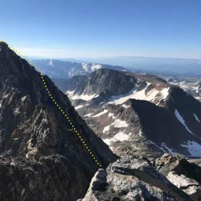
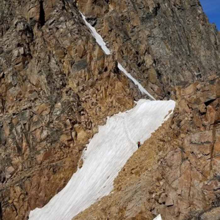
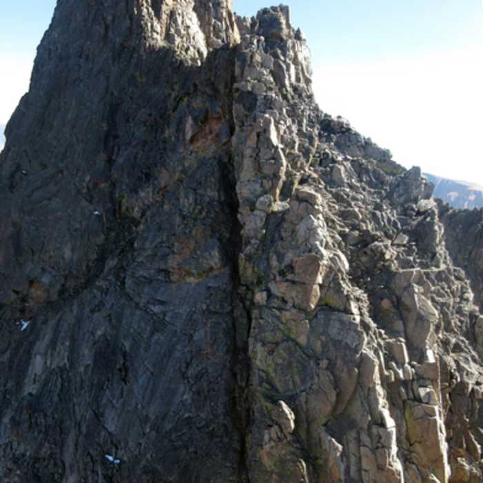
Identify the Southwest Ramp, a prominent talus-filled ramp running diagonally from left to right. Beginning around 13.0 miles, climb 1,500 vertical feet up this ramp, which features Class 3 scrambling on loose rock. Near the top of the ramp, navigate a highly exposed Class 3 chimney to reach the summit ridge, then follow the ridge east to the summit at 12,807'.
Crux: The couloir's mid-section steepens abruptly at a snow step approximately two-thirds up the ramp. This step typically holds snow through much of summer — parties can scramble around it on loose rock in dry late-season conditions, but crampons and an ice axe are recommended earlier in the season. Loose rock and rockfall hazard are persistent throughout the couloir; move one at a time through technical sections to avoid sending debris onto climbers below.
Carefully retrace your steps back down the ramp and through the basins to return to the trailhead.
No Condition Reports
Russel Creek Trail
Russel Creek Trail
Woody Falls
Woody Falls
Bridal Falls
Bridal Falls
Bliss Pass
Bliss Pass
Pebble Creek
Pebble Creek
Contributors

