
Ready to explore this trail?
View Trail Map in AppRegional Classic
A must do route for the area handpicked by local experts.
No permit is required. Barr Trailhead parking is paid ($25/day) and limited; arrive early or use the shuttle from downtown Manitou Springs.
Path Type
There and Back
The route begins and ends at Barr Trailhead, 6,707' in Manitou Springs, and runs to the summit of Pikes Peak (14,115').
From the trailhead, switchback up through forest, passing the upper terminus of the Manitou Incline on the right at about 1.0 mile. Continue climbing to Barr Camp at 6.5 miles (10,200'), a privately run camp with a cabin, tent sites, and a reliable water source — the last dependable water on the route.
Continue past Barr Camp to the A-Frame shelter at 9.0 miles (11,500'), just below treeline. Above the A-Frame, the trail steepens onto a long series of switchbacks known as the 16 Golden Stairs, climbing past Sentinel Point on the right before leveling onto a broad, boulder-strewn plateau.
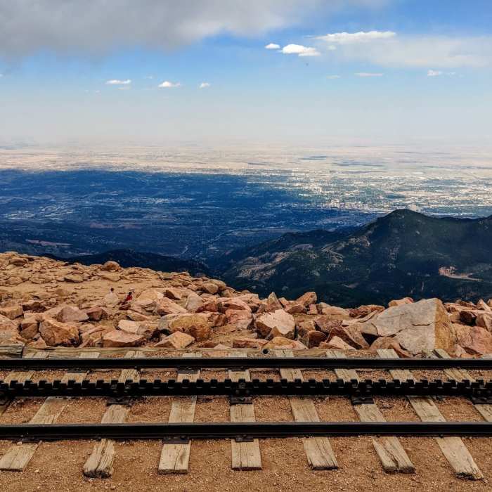
At about 11.5 miles, reach the junction with the Crags Trail at Devils Playground (13,400'); continue straight to stay on Barr Trail. The final 1.5 miles follows the shoulder of the Pikes Peak Highway to the summit (14,115'), at the Summit Visitor Center.
Descend the same route, or arrange a pick-up at the summit. Weather changes fast above treeline — thunderstorms are common on summer afternoons, and there is no cover between the A-Frame and the summit; start early and turn around if storms build. Barr Camp's caretakers post current trail and weather conditions and are a reliable check-in point on the way down.
No Condition Reports
Barr Camp Out-and-Back
Barr Camp Out-and-Back
The Manitou Springs Incline
The Manitou Springs Incline
Iron Mountain-Intemann Trail
Iron Mountain-Intemann Trail
Iron Mountain via Intemann Trail
Iron Mountain via Intemann Trail
Siamese Twins
Siamese Twins
Hogback Ridge Summit via Quarry Pass
Hogback Ridge Summit via Quarry Pass
Contributors

