

Ready to explore this trail?
View Trail Map in AppPath Type
Point to Point
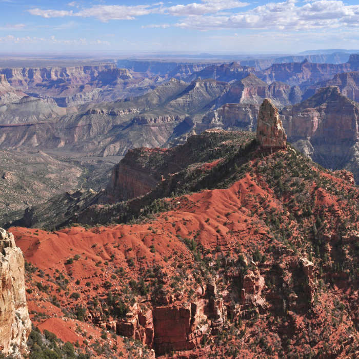
This mostly flat trail starts from the north side of the Point Imperial overlook parking lot. (Point Imperial is the highest of the North Rim overlooks) First, head through open meadow and into a big burn area. These looming pine and aspen tree shards are all that's left after the 2000 Outlook wildfire raged here. Historical factoid: This fire was the result of a prescribed burn that got out of control and it temporarily trapped tourists at Imperial Point!
The post-fire vegetation is coming back and wildflowers thrive here in the early season. The trail approaches the rim and good views into Marble Canyon can be had from various points. To the north, you can see Boundary Ridge and its highest point, !Saddle Mountain. Continue across the plateau over increasingly hilly terrain. Eventually, the trail ends at a dirt turnaround and parking area.
Note: some guidebooks list this trail as a northern extension of the Ken Patrick Trail.
No Condition Reports
Nankoweap Trail
Nankoweap Trail
Nankoweap Trail to Colorado River
Nankoweap Trail to Colorado River
Uncle Jim Complete Loop
Uncle Jim Complete Loop
Ken Patrick Trail
Ken Patrick Trail
Arizona Trail Passage 39: Grand Canyon - North Rim
Arizona Trail Passage 39: Grand Canyon - North Rim
Rim-River via North Kaibab Trail
Rim-River via North Kaibab Trail
Contributors

